Free on the App Store
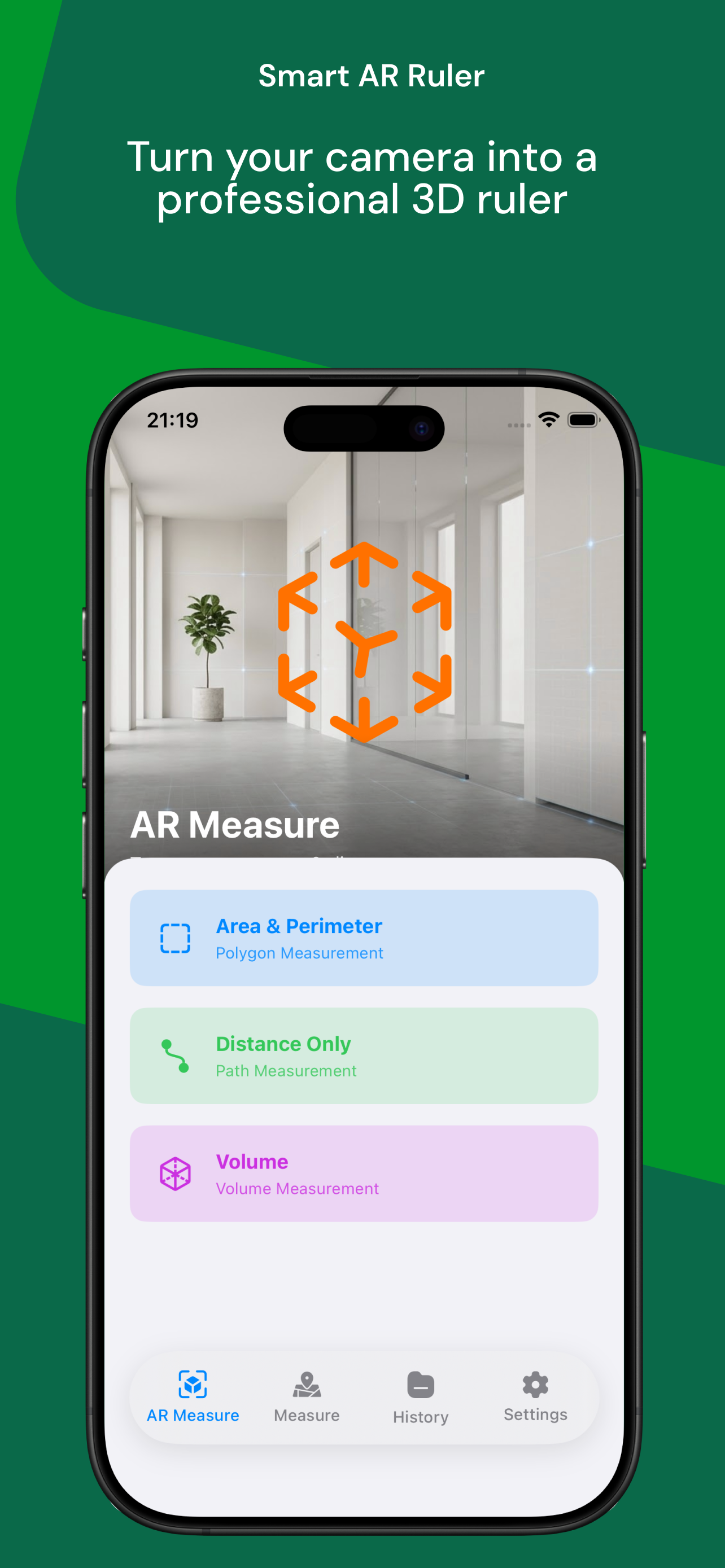
Measure Anything.
Anywhere.
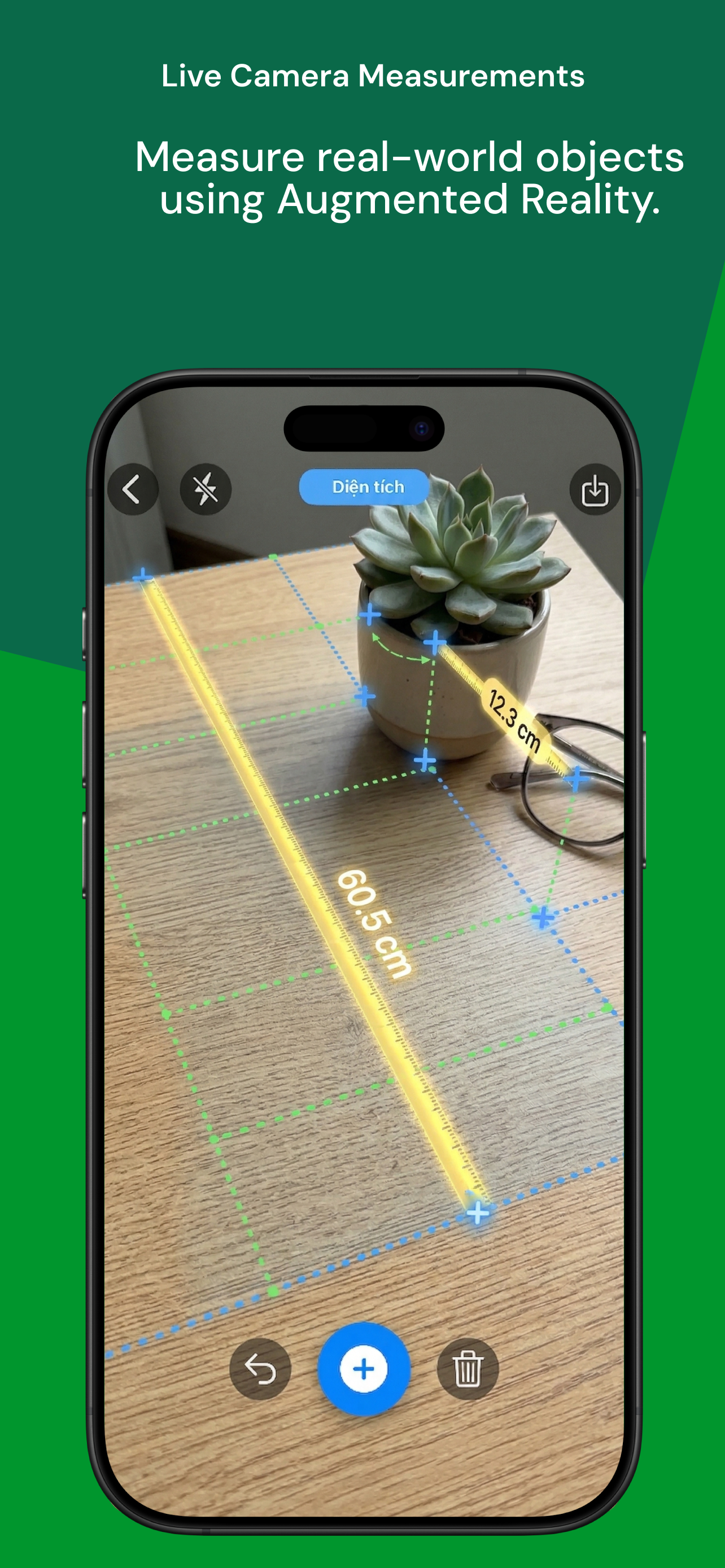
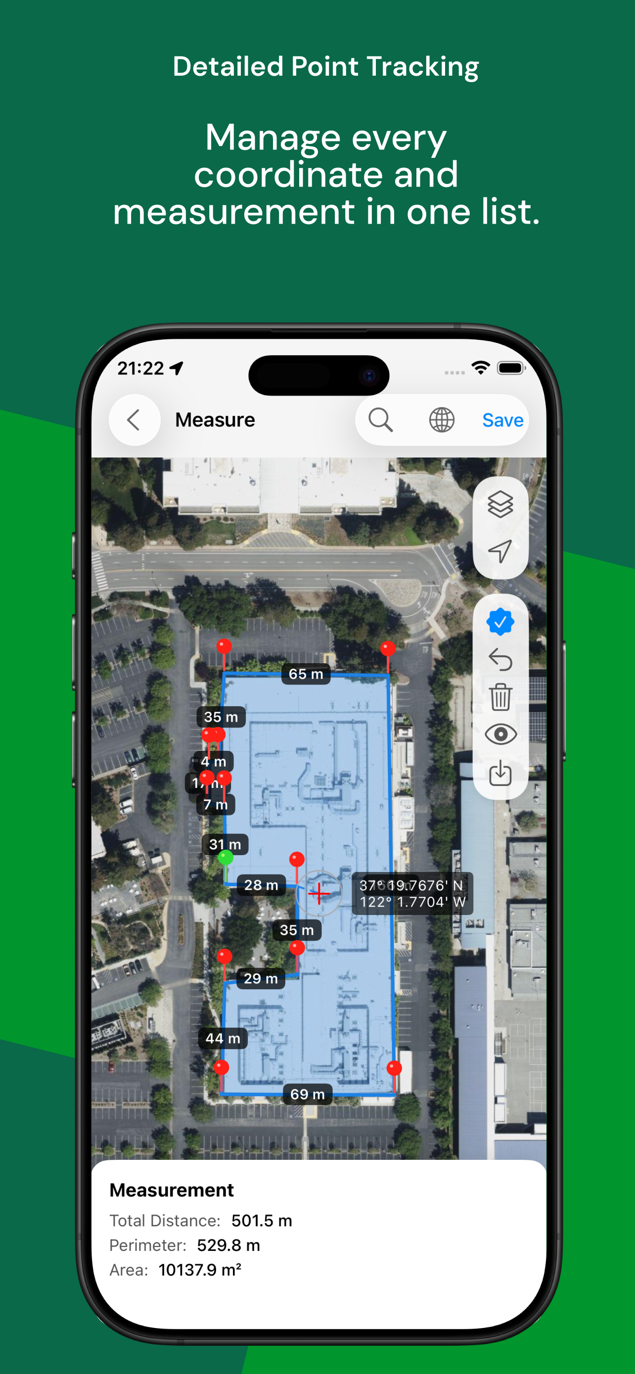
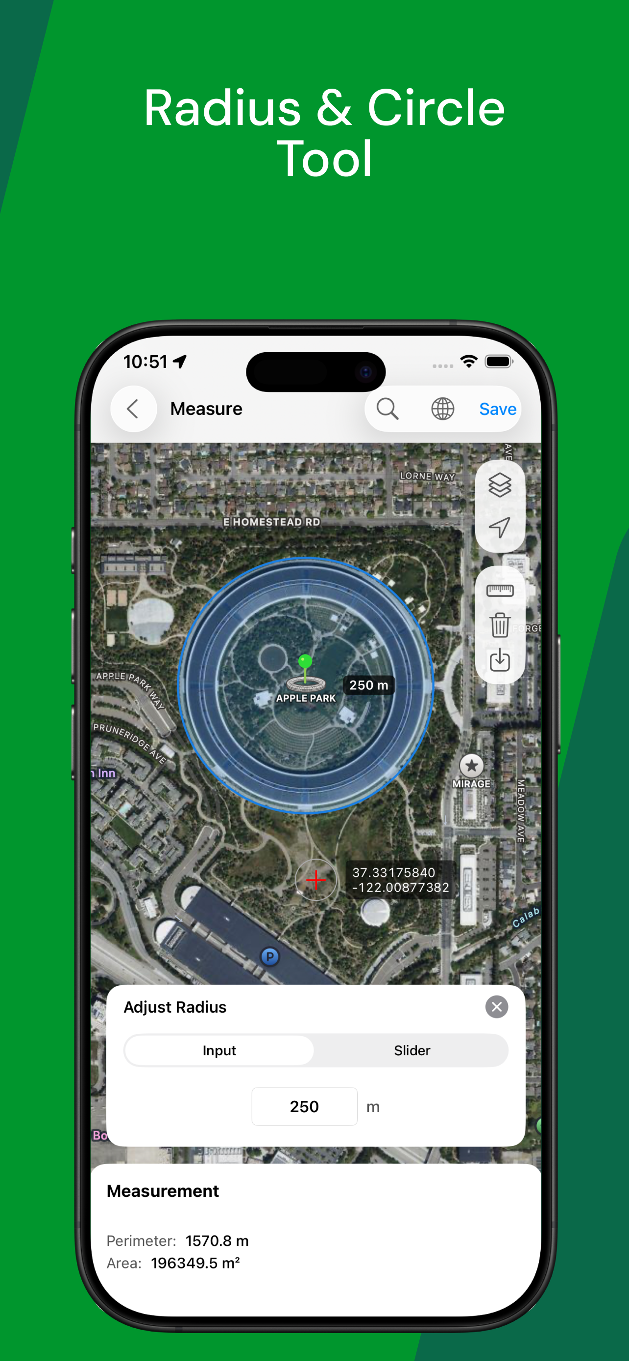
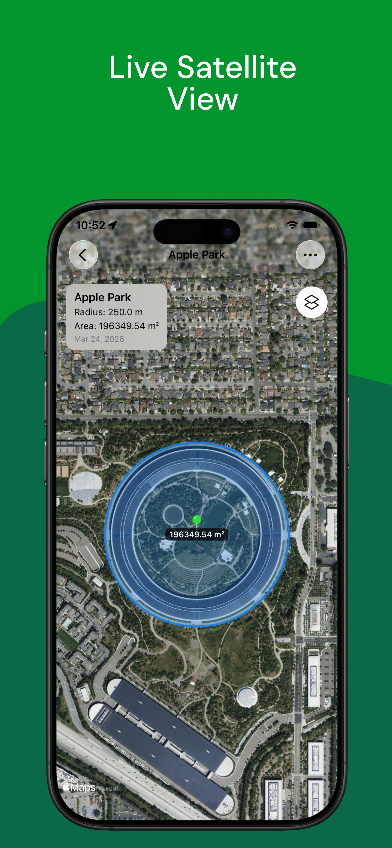
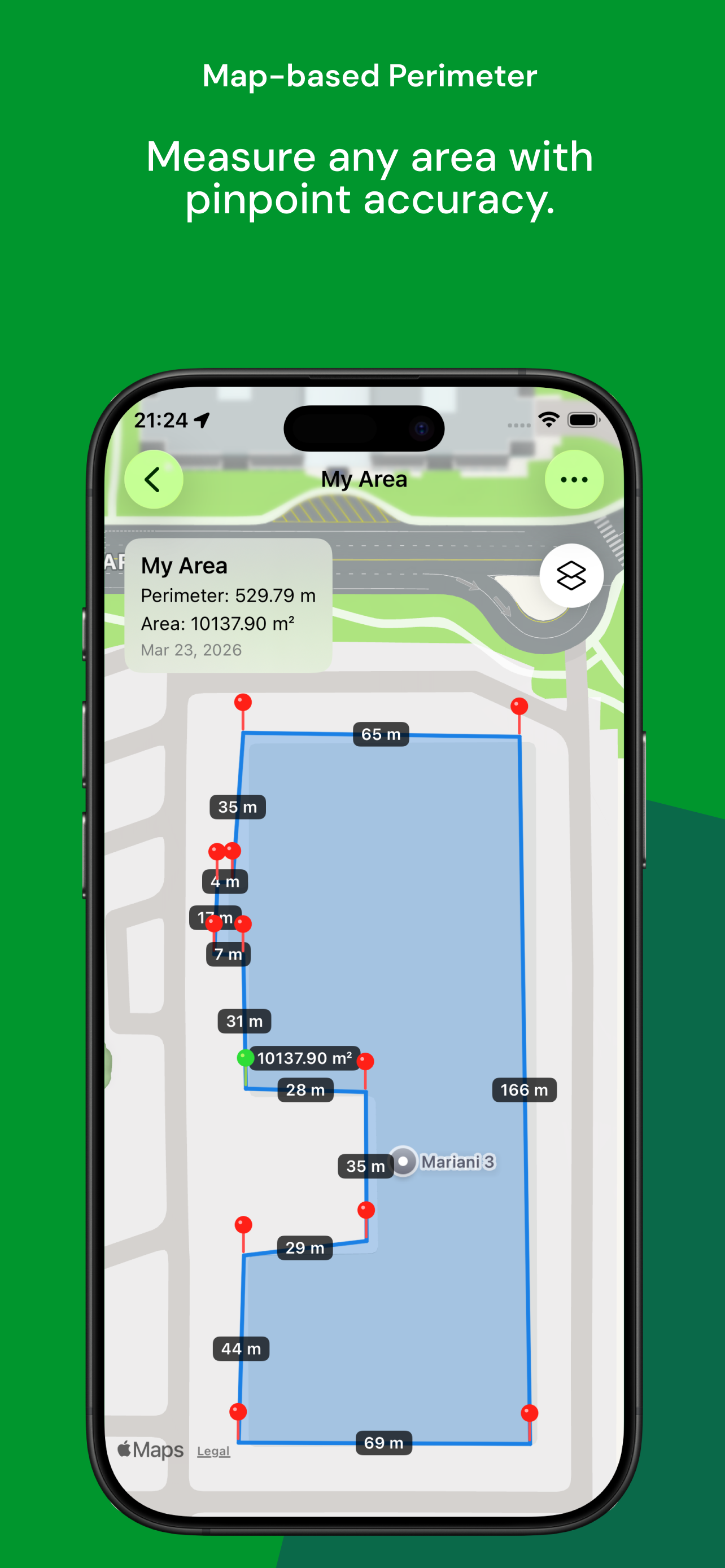
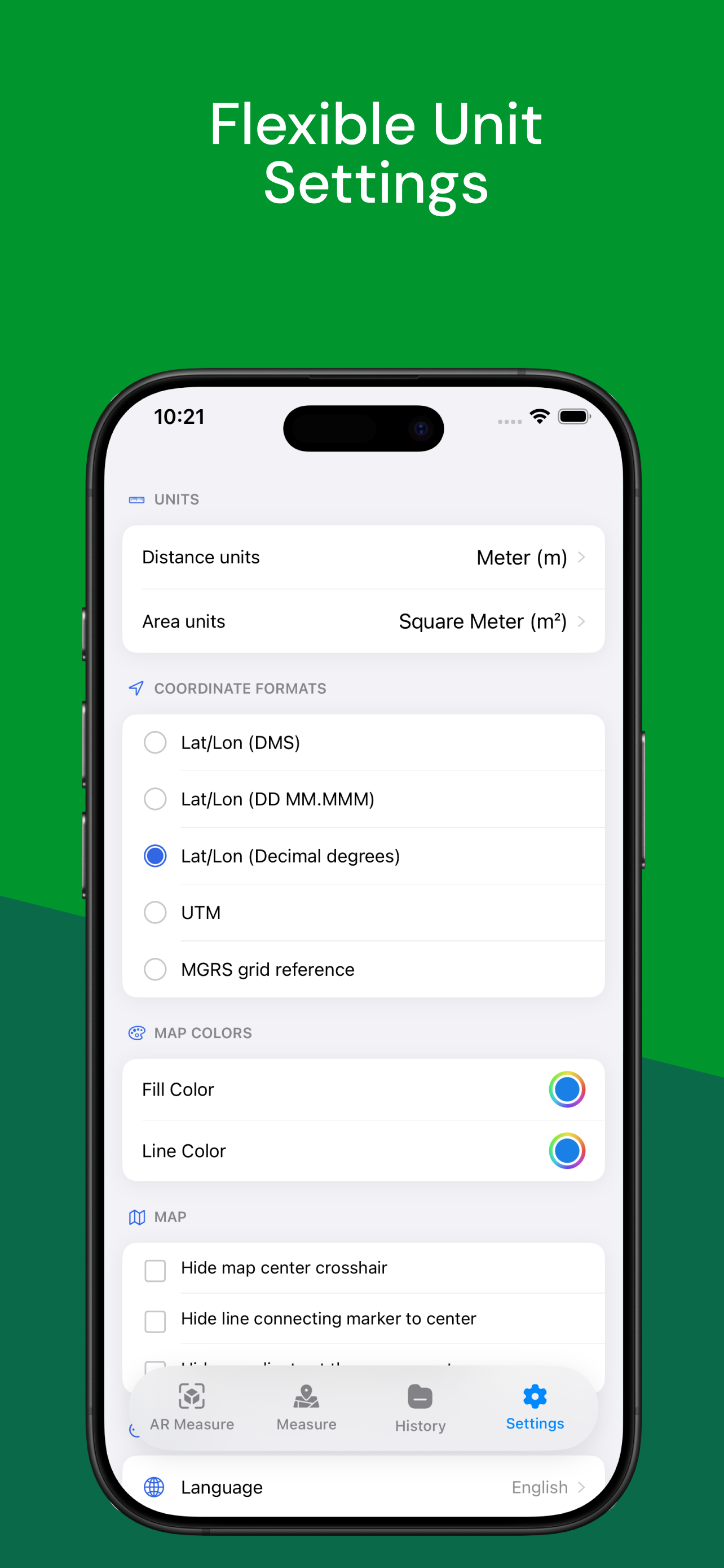
Professional GPS area measurement & AR ruler in one powerful app. Calculate areas, distances, perimeters, and 3D volumes with precision.
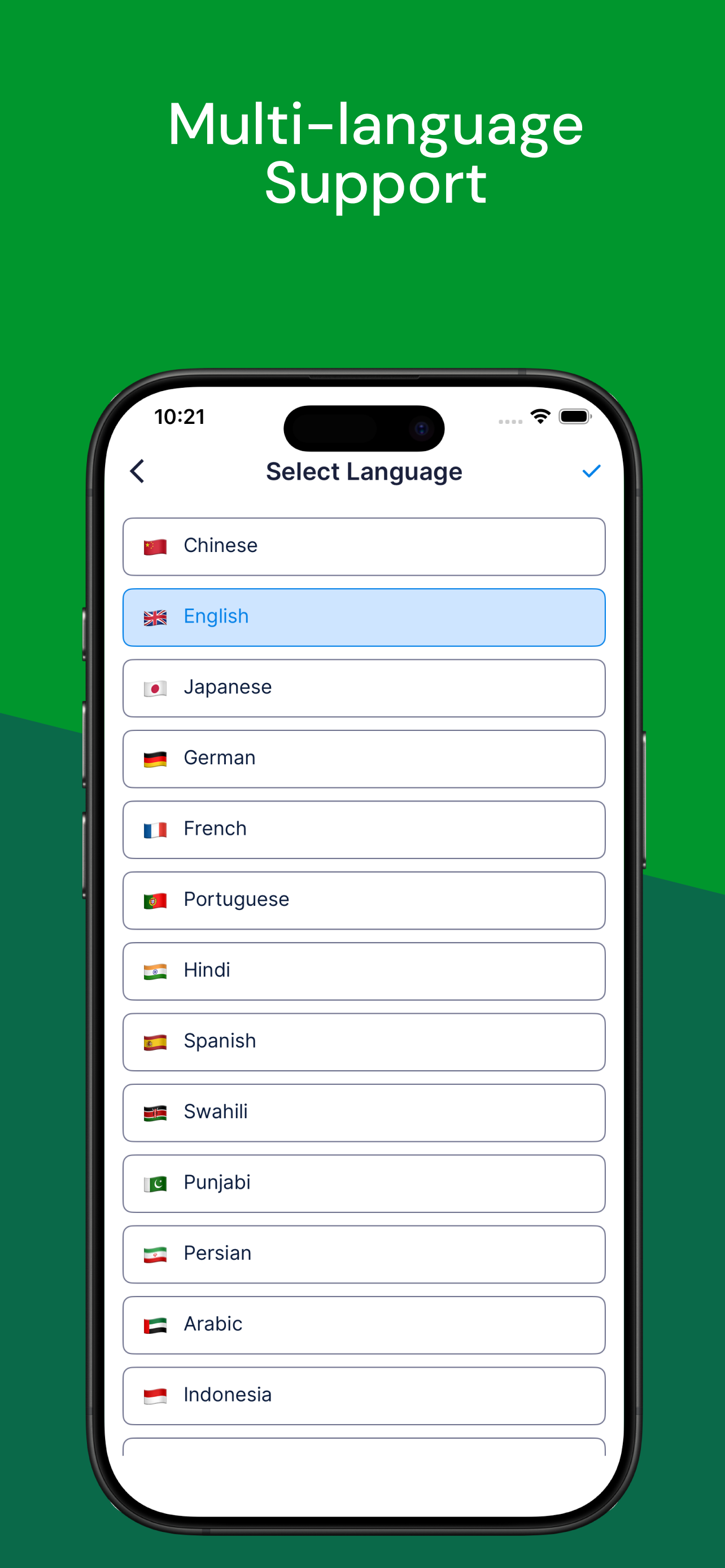
15+
Languages
2
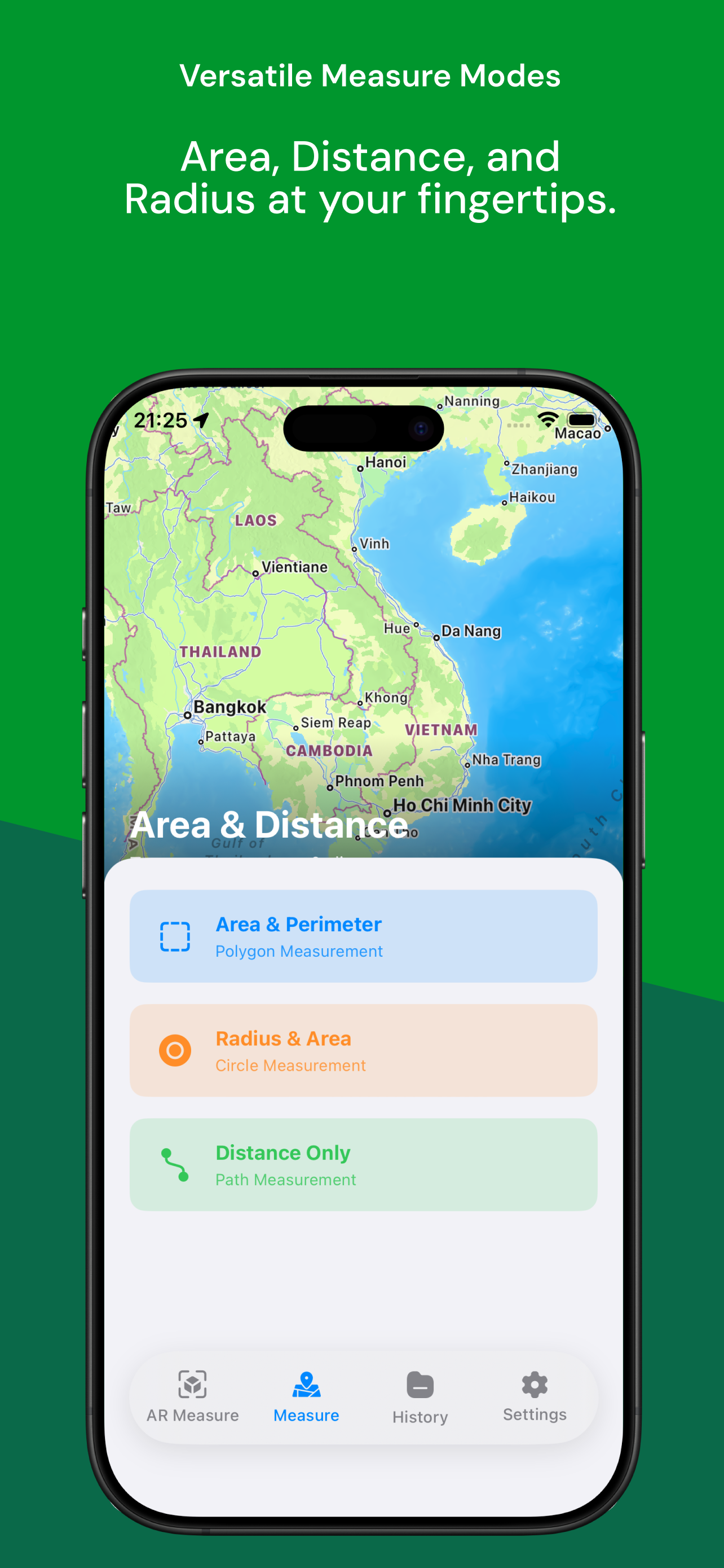
Modes: GPS & AR
Free
To Use
AR Ruler
GPS Area